UAD 3.6 series Part 2 of 7
The Signal / UAD 3.6 / November 8, 2026
The Site section turns into fieldsZoning, view and site influence in UAD 3.6
UAD 3.6 turns one view rating, a location checkbox and an adverse-conditions catch-all into 117 individually numbered Site fields. An actual GSE sample report, for a nonconforming lot in a lava flow hazard zone, shows how those fields price out in the sales comparison grid, and how one hazard answer also decides whether the loan is eligible.
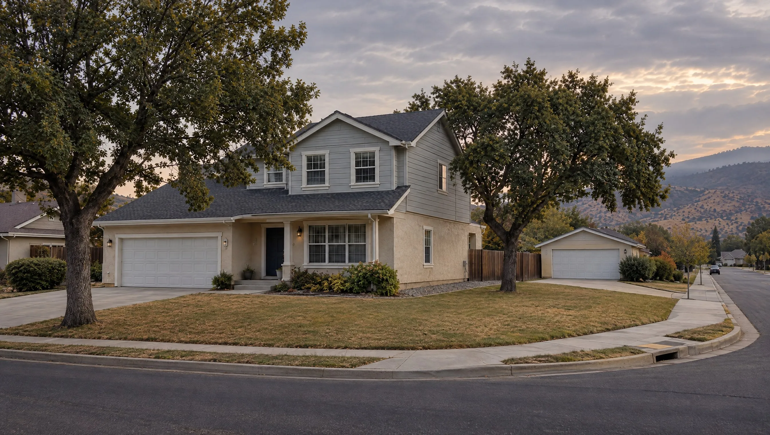
Hover or tab to the marked points on the photo to see what each house feature reports as a Site field.
Key points
- 28 named View types plus Other, and 20 named Site Influence types plus Other, replace one overall rating and up to two abbreviated factors each. Views are reported at the unit level for high-rise, mid-rise and low-rise properties, a level of detail new to UAD 3.6.
- Zoning Compliance = Legal Nonconforming AND Rebuildable to Current Density/Use = No is now a two-field query. Under UAD 2.6, finding this meant rereading the Zoning Description paragraph on every nonconforming file.
- UAD 3.6 drops the FEMA map number and map date fields that the legacy form included. The Hazard Zone field still records whether the subject is in a FEMA hazard area. The panel number and effective date now have to come from the lender's flood determination.
- An actual GSE sample puts its subject in USGS Lava Flow Zone 2, a zone outside Fannie Mae's purchase eligibility. The file shows one hazard answer pricing a value adjustment and also deciding loan eligibility, two questions the Impact rating alone leaves bundled together.
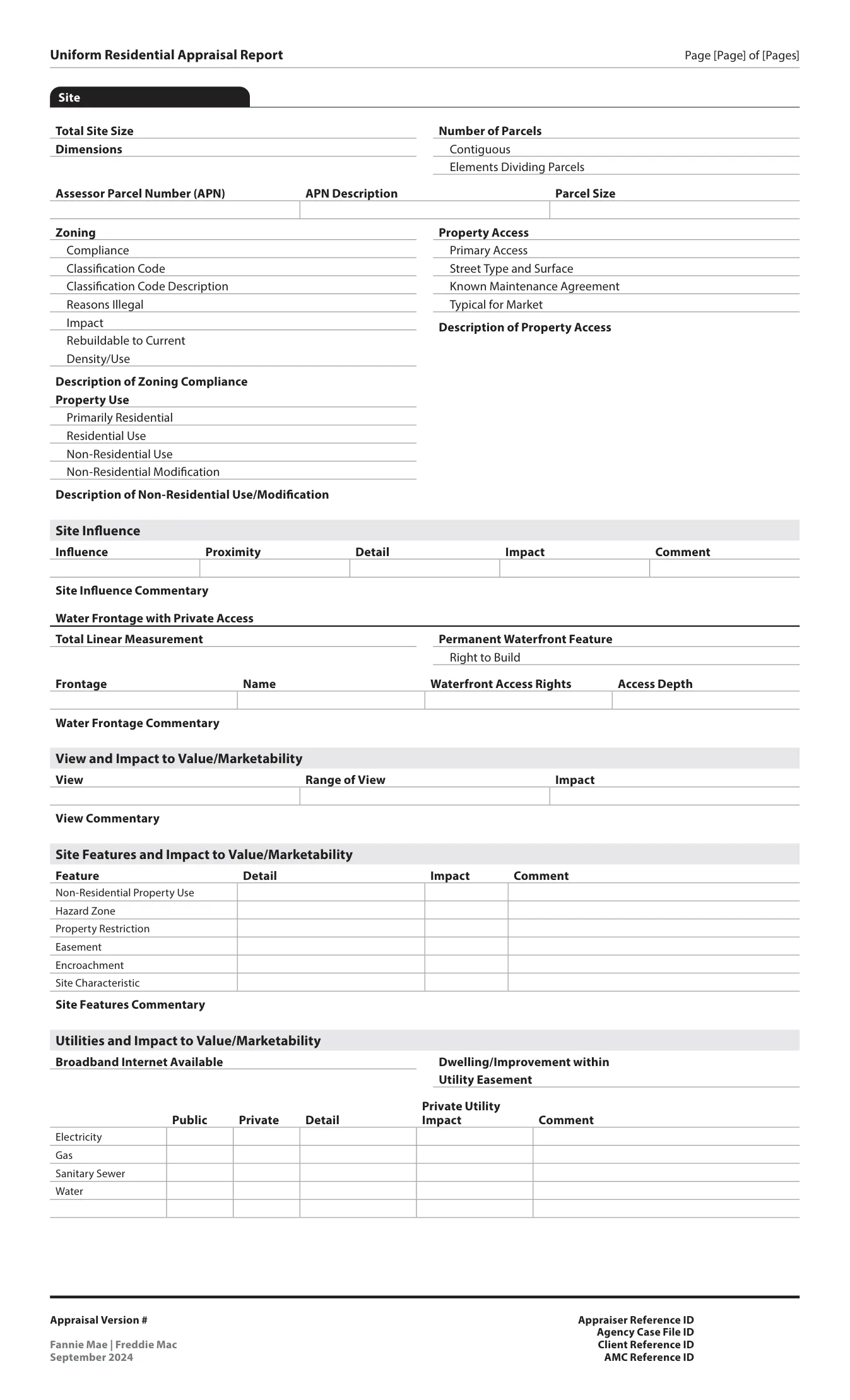
Site is section 04 of the redesigned URAR, after Summary, Assignment Information and Subject Property. The biggest change is the number of fields: the legacy form had one rating and two abbreviations, and the new form has many individually numbered fields.
117 numbered fields in the Site section
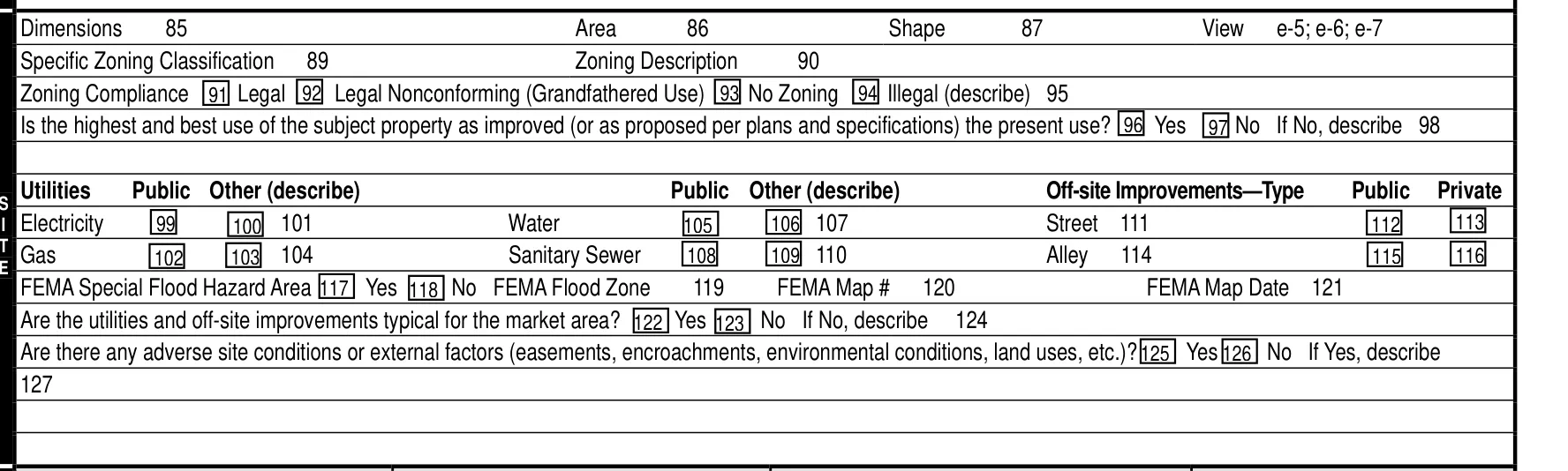
Site runs 30 pages of Appendix F-1, pp. 56 to 85, with 117 individually numbered fields, 4.000 through 4.116.1 The F-1 table of contents lists 9 top-level entries under chapter 04: Zoning, Property Use and Property Access are part of General Information, and Water Frontage with Private Access is part of Site Influence.1 The legacy Form 1004 fit its entire Site band, dimensions, zoning, utilities and the FEMA flood fields, into one dense strip on page 1.4
This part covers the Site chapter only. Part 3 picks up ANSI measurement and the sketch; Part 4 covers condition, quality and defects. Disaster mitigation gets its own post, Part 5, beyond the hazard zone connection covered here. Grid mechanics and reconciliation close out the series in Parts 6 and 7.
| # | Subsection | F-1 page |
|---|---|---|
| 01 | General Information | 56 |
| 02 | Site Influence | 62 |
| 03 | View and Impact to Value/Marketability | 69 |
| 04 | Site Features and Impact to Value/Marketability | 71 |
| 05 | Utilities and Impact to Value/Marketability | 77 |
| 06 | Apparent Defects, Damages, Deficiencies | 80 |
| 07 | Site Valuation Methodology | 82 |
| 08 | Site Commentary | 84 |
| 09 | Site Exhibits | 85 |
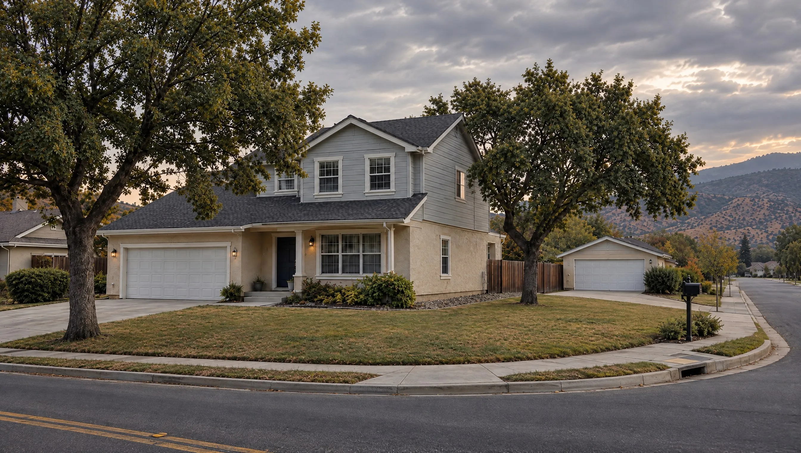
The series house for this post is the same corner lot every part in the series uses: a collector road along one side, mature oaks, a detached garage and a distant ridge beyond.2 Point at a feature in the hero image above for the Site field it describes.
The View field has 28 named types
The legacy form reported one overall rating, Neutral, Beneficial or Adverse, plus up to two factors chosen from 12 fixed abbreviations: Wtr, Pstrl, Woods, Prk, Glfvw, CtySky, Mtn, Res, CtyStr, Ind, PwrLn, LtdSght. A report might read B;Mtn;Wtr.5
Field 4.039 replaces it: select all that apply from 28 named view types, Bay through Woods, plus a separate Other (Describe) catch-all, 29 selectable answers in all. Each selected type has its own Range (Full, Partial, Seasonal or Other), Impact (Adverse, Beneficial or Neutral) and a Primary flag. Views are reported at the unit level for high-rise, mid-rise and low-rise properties, a level of detail that is new in UAD 3.6.17
| Code | Factor |
|---|---|
Wtr | Water |
Pstrl | Pastoral |
Woods | Woods |
Prk | Park |
Glfvw | Golf course view |
CtySky | City skyline view |
Mtn | Mountain view |
Res | Residential view |
CtyStr | City street view |
Ind | Industrial view |
PwrLn | Power lines |
LtdSght | Limited sight |
| Theme | Named types |
|---|---|
| Water | Bay, Canal, Cove, Creek, Gulf, Lake, Marsh, Ocean, Pond, Reservoir, River, Sound |
| Land | Golf Course, Mountain, Park, Pastoral, Valley, Woods |
| Built | City Street, Commercial, High Density Residential, Highway, Industrial, Parking Lot, School, Skyline, Traffic Wall Barriers |
| Other | Residential, plus Other (Describe) |
Impact is reported for the subject only. A comparable in the grid includes the View type and Range; the dollar adjustment stands in for a separate comparable-side Impact rating.1
Water (12)
Land (6)
Built (9)
Catch-all (1)
28 named types sum across four themes: 12 water, 6 land, 9 built environment, 1 residential catch-all, plus the separate Other (Describe) value. Source: F-1 v1.4 p. 70, cross-checked against the UAD 3.6 schema's ViewBase enumeration.17
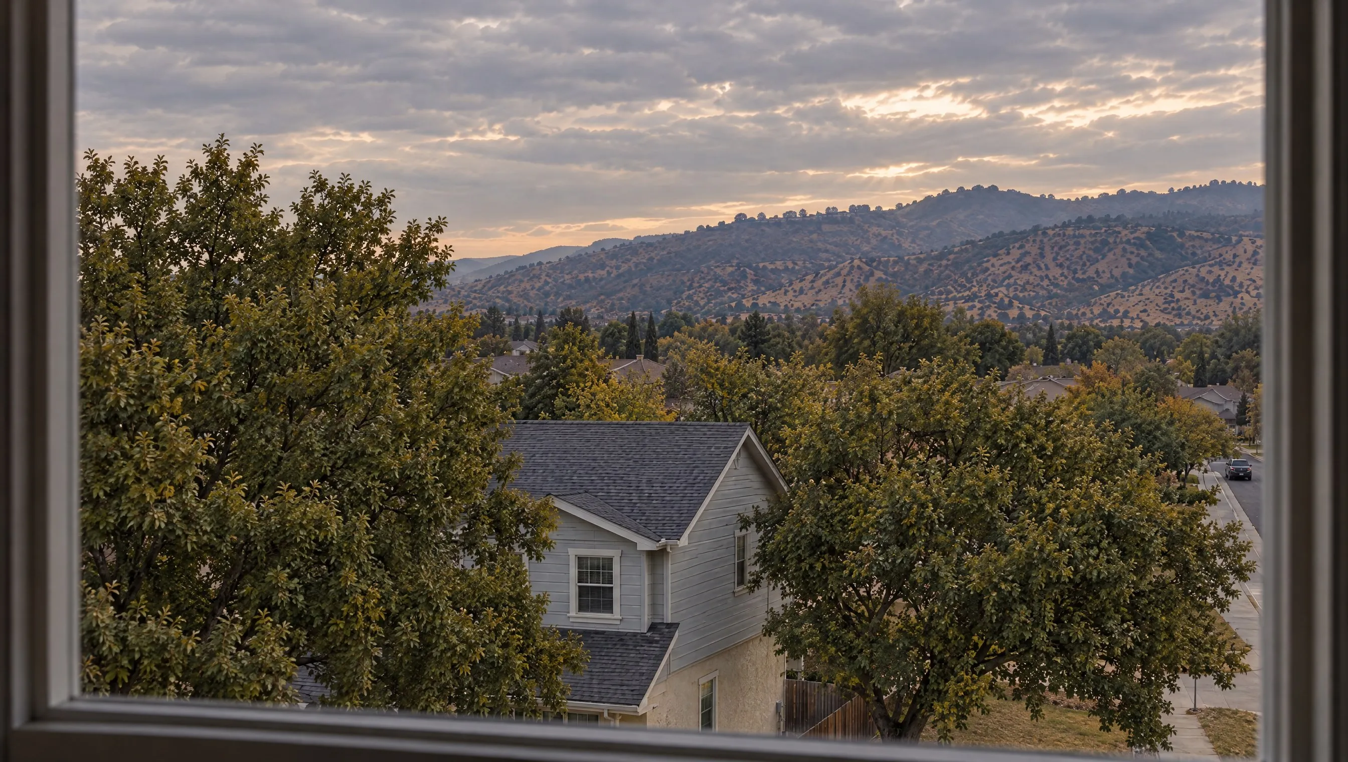
The Hawaii sample's View row reads Residential, Full, Neutral: one selected type, a full and unobstructed range, and a neutral effect on value.2
Site Influence has 20 named types
Legacy Location worked like legacy View: one overall rating plus up to two factors from a 10-abbreviation list, Res, Ind, Comm, BsyRd, WtrFr, GlfCse, AdjPrk, AdjPwr, Lndfl, PubTrn, reported only in the comparable grid. A report might read B;AdjPrk;WtrFr.5
Field 4.025, Site Influence, replaces it with 20 named types plus Other, 21 selectable answers, reported in the Site section itself as well as the grid. Each selected influence has its own Proximity (Onsite, Bordering or Offsite), Impact and Comment.17 Apparent Environmental Conditions reuse the same table shape with their own 11-item list, Radon, Landfill and Superfund Site among them, plus a Distance from Property field that only the Environmental Conditions table includes.1
Site Influence explorer
20 named types, grouped by theme
Select a type to see its Proximity and Impact options and, where the GSEs publish one, its definition.
Transportation
- OnsiteBorderingOffsite
Impact (4.028): Adverse, Beneficial or Neutral. Comment (4.029) is free-form, required only when Impact is Adverse or Beneficial.
A designated area where aircraft take off and land. Note: Airport influences can extend to flight paths where landing and take-off patterns may create higher noise levels. Choose this answer when reporting on these types of influences.
- OnsiteBorderingOffsite
Impact (4.028): Adverse, Beneficial or Neutral. Comment (4.029) is free-form, required only when Impact is Adverse or Beneficial.
F-1 gives this type no definition.
- OnsiteBorderingOffsite
Impact (4.028): Adverse, Beneficial or Neutral. Comment (4.029) is free-form, required only when Impact is Adverse or Beneficial.
A location where public transportation can be accessed (e.g., bus transfer station, metro station).
- OnsiteBorderingOffsite
Impact (4.028): Adverse, Beneficial or Neutral. Comment (4.029) is free-form, required only when Impact is Adverse or Beneficial.
The rail line used by commercial or commuter trains (e.g., railroad tracks, metro tracks).
Infrastructure
- OnsiteBorderingOffsite
Impact (4.028): Adverse, Beneficial or Neutral. Comment (4.029) is free-form, required only when Impact is Adverse or Beneficial.
A distribution system with lines in which the gas pressure in the main is higher than the pressure provided to the customer.
- OnsiteBorderingOffsite
Impact (4.028): Adverse, Beneficial or Neutral. Comment (4.029) is free-form, required only when Impact is Adverse or Beneficial.
Electric lines that commonly supply power to residential housing developments, similar facilities and individual properties.
- OnsiteBorderingOffsite
Impact (4.028): Adverse, Beneficial or Neutral. Comment (4.029) is free-form, required only when Impact is Adverse or Beneficial.
F-1 gives this type no definition.
- OnsiteBorderingOffsite
Impact (4.028): Adverse, Beneficial or Neutral. Comment (4.029) is free-form, required only when Impact is Adverse or Beneficial.
Electric lines that supply power from power generation stations to local distribution lines.
- OnsiteBorderingOffsite
Impact (4.028): Adverse, Beneficial or Neutral. Comment (4.029) is free-form, required only when Impact is Adverse or Beneficial.
An area designed to hold or retain stormwaters on a permanent basis.
Land use
- OnsiteBorderingOffsite
Impact (4.028): Adverse, Beneficial or Neutral. Comment (4.029) is free-form, required only when Impact is Adverse or Beneficial.
Crop-producing farm land. (From the UAD 3.6 schema. F-1 gives this type no definition.)
- OnsiteBorderingOffsite
Impact (4.028): Adverse, Beneficial or Neutral. Comment (4.029) is free-form, required only when Impact is Adverse or Beneficial.
An area intended to produce income (e.g., office buildings, retail buildings, hospitality).
- OnsiteBorderingOffsite
Impact (4.028): Adverse, Beneficial or Neutral. Comment (4.029) is free-form, required only when Impact is Adverse or Beneficial.
F-1 gives this type no definition.
- OnsiteBorderingOffsite
Impact (4.028): Adverse, Beneficial or Neutral. Comment (4.029) is free-form, required only when Impact is Adverse or Beneficial.
A densely populated residential area.
- OnsiteBorderingOffsite
Impact (4.028): Adverse, Beneficial or Neutral. Comment (4.029) is free-form, required only when Impact is Adverse or Beneficial.
A district designated to be of historical significance by a recognized authority.
- OnsiteBorderingOffsite
Impact (4.028): Adverse, Beneficial or Neutral. Comment (4.029) is free-form, required only when Impact is Adverse or Beneficial.
An area intended for the production of manufactured goods (e.g., factories).
- OnsiteBorderingOffsite
Impact (4.028): Adverse, Beneficial or Neutral. Comment (4.029) is free-form, required only when Impact is Adverse or Beneficial.
F-1 gives this type no definition.
- OnsiteBorderingOffsite
Impact (4.028): Adverse, Beneficial or Neutral. Comment (4.029) is free-form, required only when Impact is Adverse or Beneficial.
F-1 gives this type no definition.
Natural
- OnsiteBorderingOffsite
Impact (4.028): Adverse, Beneficial or Neutral. Comment (4.029) is free-form, required only when Impact is Adverse or Beneficial.
Choose this answer if there are one or more bodies of water that influence the site. Note: If applicable, see also the Water Frontage with Private Access subsection (4.031-4.038).
- OnsiteBorderingOffsite
Impact (4.028): Adverse, Beneficial or Neutral. Comment (4.029) is free-form, required only when Impact is Adverse or Beneficial.
An area of protected or conserved land or water on which development is indefinitely set aside.
- OnsiteBorderingOffsite
Impact (4.028): Adverse, Beneficial or Neutral. Comment (4.029) is free-form, required only when Impact is Adverse or Beneficial.
F-1 gives this type no definition.
Source: F-1 v1.4 pp. 62 to 63; schema annotations from GSE_UAD_3.6.0_EnumeratedTypes_v1.3.xsd.17 Every type has the same three Proximity options, and which one applies is reported per file, independent of the type.
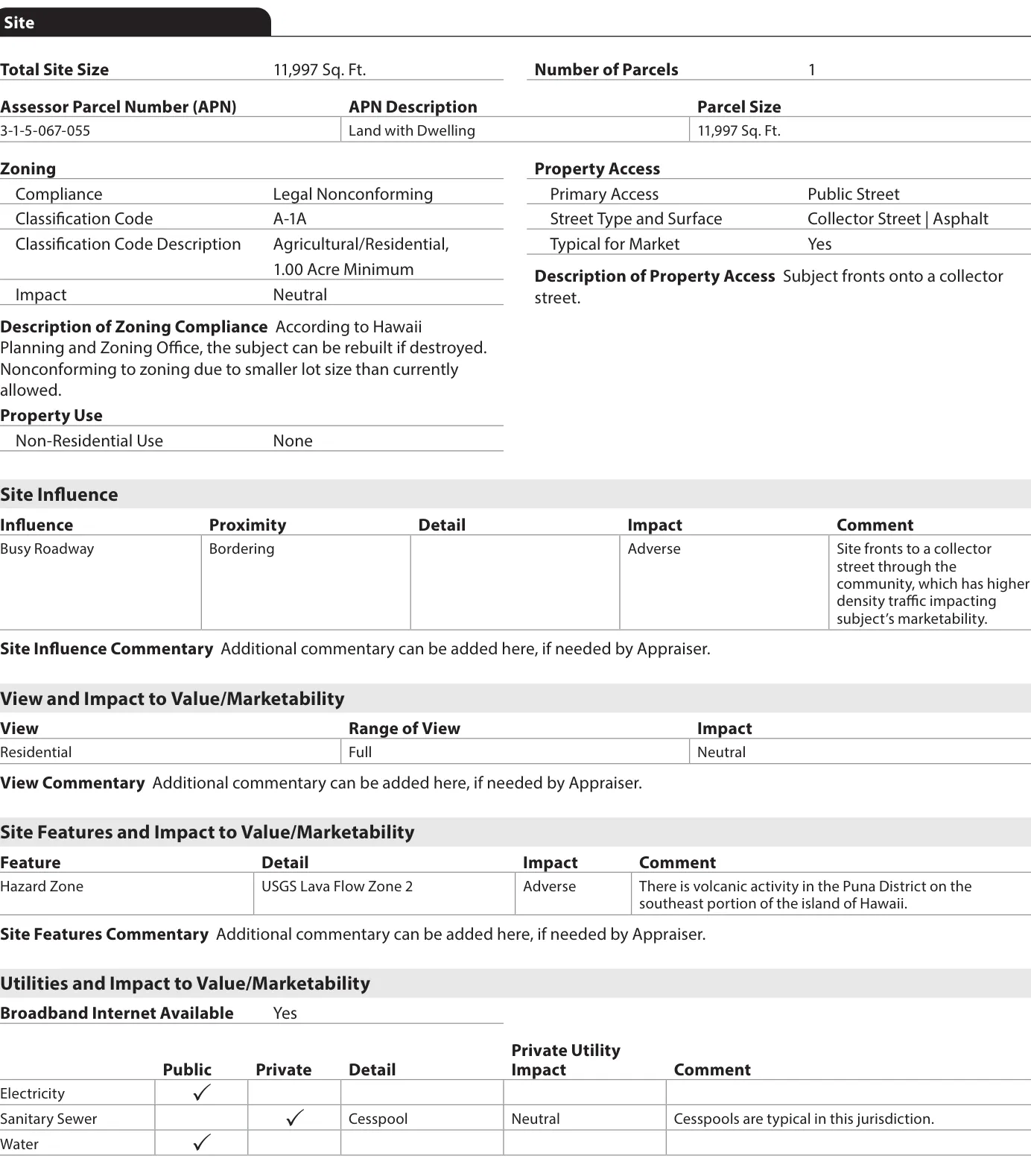
The Hawaii sample's Site Influence row reads Busy Roadway, Bordering, Adverse: "Site fronts to a collector street through the community, which has higher density traffic impacting subject's marketability."2
The Hawaii sample's Site section
The printed Site section
The same answers as data fields
4.025Site InfluenceBusy Roadway4.026ProximityBordering4.028Site Influence ImpactAdverse4.039ViewResidential4.040Range of ViewFull4.041View ImpactNeutral
Top row: Site Influence. Bottom row: View, which records what is visible from the dwelling.
In the Sales Comparison grid, Site Influence reappears as row 22.03.13/22.03.42, with the same 20-type enumeration. Only Body of Water Type travels into the grid, under the same row; Proximity and Comment stay in the Site section, and Apparent Environmental Conditions gets its own adjustable row (22.03.14/22.03.44). The Hawaii sample's Comp 1 shows both together: its grid cell reads "Busy Roadway | Ocean," the Site Influence type and the Body of Water Type combined.12 Part 6 covers full grid mechanics. This part covers only the Site-specific rows.
Zoning Compliance has four linked fields
Zoning Compliance (4.008) is Illegal, Legal, Legal Nonconforming or No Zoning. Classification Code (4.009) has a separate Description field (4.010). An Illegal answer requires one or more of six Reasons Illegal. A Legal Nonconforming answer adds Rebuildable to Current Density/Use (4.013), required on FHA, USDA and VA files.1
The Hawaii sample reads Legal Nonconforming, code A-1A, "Agricultural/Residential, 1.00 Acre Minimum." Its commentary: "According to Hawaii Planning and Zoning Office, the subject can be rebuilt if destroyed. Nonconforming to zoning due to smaller lot size than currently allowed."2
Press a Compliance answer to see which fields it puts in play.
- 4.009 Classification Code
- 4.010 Code Description
- 4.014 Description
A conforming use skips the Impact field, by definition.
Reasons Illegal (4.011), six values: Accessory Dwelling Unit, Development Standards, Excessive Units, Lot Size, Manufactured Home, Other. Source: F-1 v1.4 pp. 58 to 59.1
Fannie Mae purchases only legal-conforming-use properties, or legal nonconforming properties where the appraisal reflects any adverse marketability effect. A loan is ineligible if the property is subject to certain land-use regulations, such as coastal tideland or wetland laws, that would prevent reconstruction or maintenance of the improvements if they were damaged or destroyed.3 Rebuildable to Current Density/Use (4.013) is a government-loan field, required only for FHA, USDA and VA appraisals. The Hawaii sample's "can be rebuilt if destroyed" statement appears in free-text zoning commentary. It does not populate field 4.013.2
Highest and best use touches Site only at the edges. The four tests (16.000 to 16.003) and the present-use conclusion (16.004) live in chapter 16 of F-1, separate from Site. "The highest and best use must be residential" is a Selling Guide eligibility overlay, outside the form fields themselves.1 The form has no checkbox asking whether the highest and best use is residential. Our highest and best use feature covers the four tests and the eligibility matrix in full, so this part leaves them there.
What changed in the Hazard Zone field
Hazard Zone (4.047) has four answers: FEMA Special Flood Hazard Area, USGS Lava Flow Zone (with a zone number, 1 through 9, when selected), None (No Hazard Zone Noted), or Other, plus Impact (4.048) and Comment (4.049).1
The legacy 1004 included the Special Flood Hazard Area Yes/No checkbox plus three explicit fields: FEMA Flood Zone, FEMA Map # and FEMA Map Date.4 The URAR still records whether the subject is in a FEMA hazard area, but the map number and map date are gone: Site, the Disaster Mitigation chapter and the UAD 3.6 schema all leave them out.17 The panel number and its effective date now have to come from the lender's flood determination instead of the appraisal.
Legacy Form 1004, p. 1
117/118 FEMA Special Flood Hazard Area (Yes/No)119 FEMA Flood Zone120 FEMA Map #121 FEMA Map Date
UAD 3.6 Hazard Zone (4.047 to 4.049)
4.047 Hazard Zone (type only)4.048 Impact4.049 Comment
No map number or map date field.
Source: legacy Form 1004/70, p. 1.4 F-1 v1.4, p. 72; XSD element names checked for "Flood," "FIRM" and "Panel."17
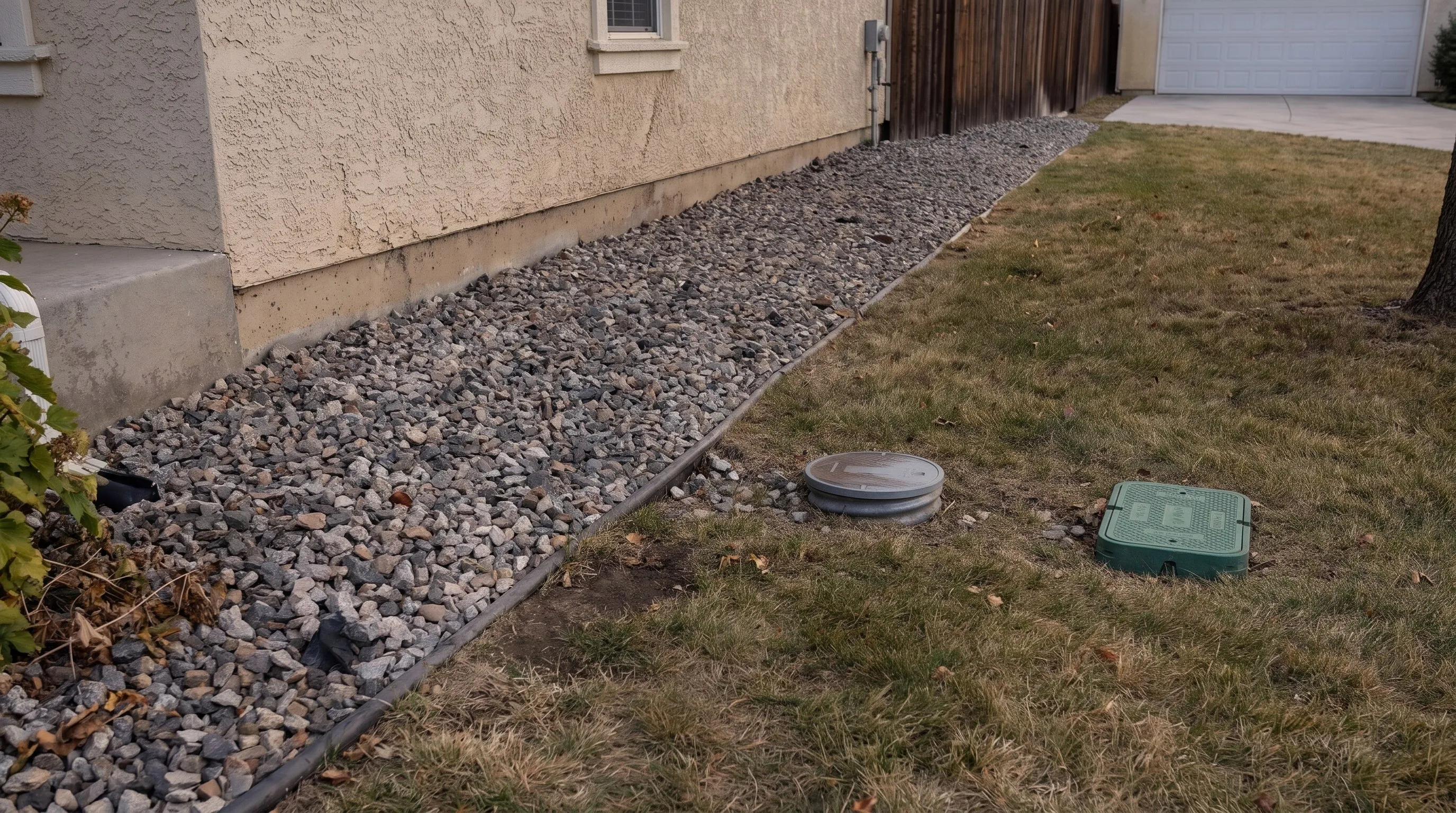
Each of Electricity, Gas, Sanitary Sewer, Water and Other grew from two legacy checkboxes to as many as 6 fields: Public, Private, a Shared flag, Impact and Comment, plus a private-source Detail for Electricity, Sanitary Sewer and Water only.1 Private streets have their own Known Maintenance Agreement flag (4.022). Easements (Conservation, Drainage, Ingress/Egress, Utility, Other) and encroachments (Building, Driveway, Fence, Overhang, Other, plus a required direction, Bordering Property Encroaching on Subject Property or Subject Property Encroaching on Bordering Property) are separate enumerated rows instead of one bundled "adverse conditions" field.1
- Private source detail
- Battery Storage, Permanent Generator, Solar, Wind, Other
- Also reported
- Shared (Yes/No), Impact (Adverse/Beneficial/Neutral), Comment
- Private source detail
- No Detail field for this utility
- Also reported
- Shared (Yes/No), Impact (Adverse/Beneficial/Neutral), Comment
- Private source detail
- Cesspool, Septic, Other
- Also reported
- Shared (Yes/No), Impact (Adverse/Beneficial/Neutral), Comment
- Hawaii sample
- Private, Cesspool, Neutral: "Cesspools are typical in this jurisdiction."2
- Private source detail
- Cistern, Hauled Water Holding Tank, Lake or Spring, Well, Other
- Also reported
- Shared (Yes/No), Impact (Adverse/Beneficial/Neutral), Comment
- Private source detail
- No Detail field for this utility
- Also reported
- Shared (Yes/No), Impact (Adverse/Beneficial/Neutral), Comment
Source: F-1 v1.4 pp. 77 to 80.1 Broadband Internet Available (4.067) is new to UAD 3.6 and has no legacy analog.
Private or community streets require an adequate, legally enforceable maintenance agreement or covenant, which should be recorded in the land records, unless the property is in a state with statutory maintenance provisions. If there is no qualifying agreement, the lender may still sell the loan but must indemnify Fannie Mae under Selling Guide A2-1-03.3
One hazard answer affects both value and eligibility
This chapter uses the 2- to 4-unit Appraisal (Hawaii) sample, an actual GSE scenario, distinct from the series' fictional corner-lot house in the hero. Its Site section: 11,997 Sq. Ft., Legal Nonconforming A-1A zoning, Busy Roadway site influence bordering and adverse, Residential view full and neutral, USGS Lava Flow Zone 2 hazard adverse, private cesspool sewer.2
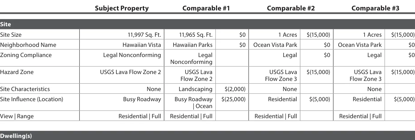
| Comp | Hazard Zone | Adj. | Site Influence | Adj. | View | Range |
|---|---|---|---|---|---|
| Subject | USGS Lava Flow Zone 2 | — | Busy Roadway | — | Residential | Full |
| Comp 1 | USGS Lava Flow Zone 2 | — | Busy Roadway | Ocean | −$25,000 | Residential | Full |
| Comp 2 | USGS Lava Flow Zone 3 | −$15,000 | Residential | −$5,000 | Residential | Full |
| Comp 3 | USGS Lava Flow Zone 3 | −$15,000 | Residential | −$5,000 | Residential | Full |
Source: 2- to 4-unit Appraisal (Hawaii), v1.4, rendered p. 15.2 Comp 1 also has a −$2,000 Site Characteristics adjustment for landscaping, outside this table.
Two different questions, one field. Comp 1 shares the subject's Zone 2; its Hazard Zone adjustment cell is blank in the grid, the same as its Zoning Compliance cell. Comps 2 and 3 are in the less severe Zone 3 and each draw a −$15,000 hazard adjustment. That priced difference is a value question, and the Impact (4.048) and Comment (4.049) fields answer it. Separately, Fannie Mae purchases loans only in USGS lava flow zones 3 through 9; zones 1 and 2 are categorically ineligible.3 The sample places its own subject in Zone 2, on the ineligible side of that cutoff. The Impact rating treats a priced severity difference and an eligibility question the same way.
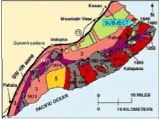
Under 2.6, this same property would have reported one Location rating with up to two abbreviated factors and one View rating with up to two factors. UAD 3.6 adds the lava flow zone concept and structured cesspool detail, both new since 2.6.
What a collateral risk team can check in the Site section
Each capability below reads fields that every UAD 3.6 report has, and works from the report itself, with no vendor geospatial feed or PDF text extraction required.
| Capability | Reads | Replaces | Where it stops |
|---|---|---|---|
| Zoning eligibility screen | 4.0084.0114.013 | Reading the Zoning Description paragraph on every nonconforming file | Reasons Illegal and Rebuildable only arrive when Compliance calls for them; a conforming file has neither. |
| Private street indemnification screen | 4.0204.022 | A free-text Property Access description | Known Maintenance Agreement is Yes/No only; the field stops at that flag. |
| Lava-zone eligibility gate | 4.047 | A capability new to UAD 3.6, since the legacy form had no lava-zone concept at all. | The gate needs the zone number itself. Impact (4.048) alone treats an ineligible zone the same as a merely unfavorable one. |
| Other-usage data-quality rate | 4.025 | Also new to UAD 3.6: the 2.6 abbreviation list had no Other-rate concept either. | Needs a fuzzy match against the enumeration list. The GSE-documented pattern is one example to build from, short of a certified detector. |
| Encroachment direction flag | 4.0584.059 | One bundled Yes/No "adverse site conditions" field | Flags the condition; resolving the title question is separate work. |
| Site Influence and View exposure map | 4.0254.0264.0394.0404.041 | Up to two abbreviations per legacy rating, decoded by hand | Impact is reported for the subject only. Comparables show type and range in the grid, with no separate comparable-side impact rating. |
# Field IDs: Appendix F-1 v1.4. Thresholds and routing are the lender's choice.

# R1. Zoning hard-stop and rebuildability
IF report[4.008] == "Illegal":
    FLAG "zoning_ineligible"
ELSE IF report[4.008] == "Legal Nonconforming" AND report[4.013] == "No":
    FLAG "nonconforming_not_rebuildable"

# R2. Private street indemnification
IF report[4.020] == "Private Street" AND report[4.022] == "No":
    FLAG "private_street_no_agreement"

# R3. Hazard zone eligibility is a different question than the value adjustment
IF report[4.047] == "USGS Lava Flow Zone" AND zone IN {1, 2}:
    FLAG "ineligible_lava_zone"            # SB2-3-04, hard stop, independent of Impact (4.048)
ELSE IF report[4.047] == "USGS Lava Flow Zone" AND zone IN {3..9}:
    continue_with_value_adjustment          # Impact (4.048) / Comment (4.049) / grid dollar amount

# R4. "Other" overuse as a data-quality signal
rate = COUNT(SiteInfluence(4.025) == "Other" AND freeText fuzzy-matches an existing enumeration)
       / COUNT(all Site Influence entries)
IF rate > LENDER_THRESHOLD: discount_quality_score(appraiser)

# R5. Encroachment direction as a title-risk flag
IF EncroachmentDirection(4.059) == "Subject Property Encroaching on Bordering Property":
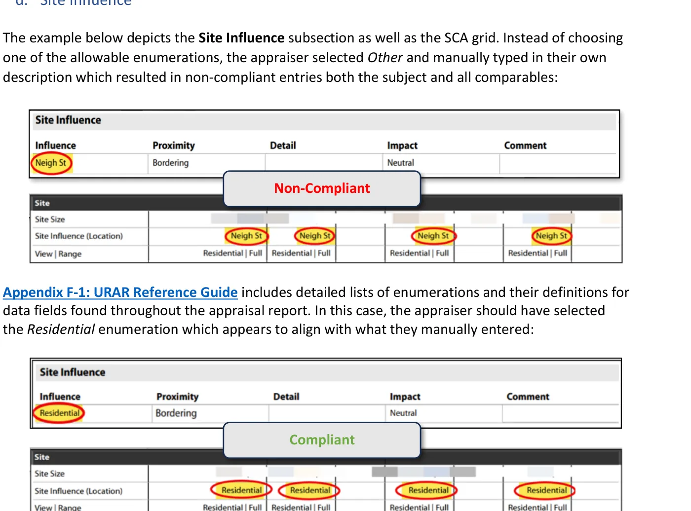
FLAG "title_risk_subject_encroaches"Non-compliant
Site Influence (4.025), via Other (Describe)
Value: "Neigh St"
Free text propagated unchanged into the subject and all three comparables in the grid.
Compliant
Site Influence (4.025)
Value: Residential
The correct enumeration, selected outright. Comment is required only when Impact is Adverse or Beneficial.
Existing adjacent data layers, such as FEMA's flood map services, parcel-linked zoning products and imagery-derived condition tools, are vendor-stated capabilities; whether they integrate with UAD 3.6 is unconfirmed.1 We found no GSE statement on AI pre-population of UAD 3.6 Site fields in the documents we checked. A CU message warning about View and Site Influence smoothing across subject and comparables has existed since 2.6, though its current wording and volume are not verified here and so are left uncounted.
Where the data stops
- Three-value Impact is still a judgment call. Adverse, Beneficial or Neutral can imply more certainty than the underlying read supports, and it becomes a market-calibrated dollar figure only once it reaches the grid as an adjustment.
- Enumerations can be gamed. Comment is required only when Impact is Adverse or Beneficial, so selecting Neutral avoids having to explain an influence.
- The field count is a workload cost too. Utilities alone grew from 2 checkboxes to up to 6 fields each; more rows and more required Impact and Comment pairs mean more inspection time.
- An AMC's role has limits. An Other-overuse rate is a pattern check on form compliance, which a QC function can act on. It cannot direct the Impact or Comment an appraiser enters on a specific file, which stay that appraiser's judgment under AIR.
What a risk team should check next
Five items, read against your own intake and QC rules. Your progress is saved in this browser.
Site section review
0 of 5 checked
Saved in this browser only.
Now that Site Influence and View report Impact for the subject only, how should a reviewer build a consistency check, given that the grid does not include a separate comparable-side impact rating to compare against?
Research checked Nov. 2, 2026 against the GSE documents listed below. Field counts, enumeration counts and grid adjustments were read and recomputed by ValuSignal from the primary GSE documents for this build. The corner lot, the road and the window view are fictional and were generated with Higgsfield; the form pages and sample sections are screenshots of GSE publications. General information, not legal, lending or appraisal advice.
Sources
8 documents, accessed Oct. 16 to Nov. 2, 2026
- Fannie Mae and Freddie Mac, Appendix F-1: URAR Reference Guide, v1.4, chapter 04 (Site), pp. 56 to 85, and chapter 16 (Highest and Best Use)March 10, 2026
- Fannie Mae and Freddie Mac, Appendix D-1: URAR Sample Scenarios and XML Files, 2- to 4-unit Appraisal (Hawaii) and SF3, v1.4March 10, 2026
- Fannie Mae, Selling Guide Supplement: UAD 3.6 Policy, SB2-3-04 (Hawaiian lava flow zones) and SB4-1.3-04 (Property Site, Disaster Mitigation and Highest and Best Use)Sept. 2, 2026
- Fannie Mae and Freddie Mac, UAD Specification Appendix C: Form 1004/70 with numbered fieldsForm dated March 2005
- Fannie Mae and Freddie Mac, Appendix A: GSE Appraisal Forms Mapping, Document Version 1.5 (legacy View and Location abbreviations, pp. 21 and 40 to 41)Feb. 3, 2022
- Fannie Mae and Freddie Mac, Appendix C-1: URAR layout, v1.3Current package
- Fannie Mae and Freddie Mac, UAD 3.6 schema, enumerated types v1.3 (ViewBase, SiteInfluenceBase)Current package
- Fannie Mae and Freddie Mac, UAD 3.6 Job Aid: Guidance for Appraisers through Lessons Learned, v1.0, p. 8June 23, 2026
The Signal / Twice-monthly briefing
Get the next UAD 3.6 analysis in your inbox.
One sourced briefing twice a month on valuation policy, collateral risk and property technology.
Unsubscribe in one click. We don't sell your email or share it with sponsors. Privacy Policy